
IELTS Academic Writing Task 1Topic
Land use
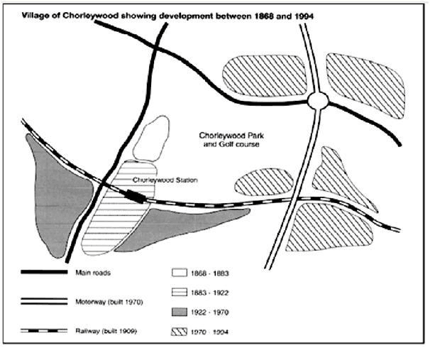
Development of Chorleywood Village Between 1868 and 1994
Chorleywood is a village near London whose population has increased steadily since the middle of the nineteenth century. The map below shows the development of the village. Summarise the information by selecting and reporting the main features, and make comparisons where relevant.
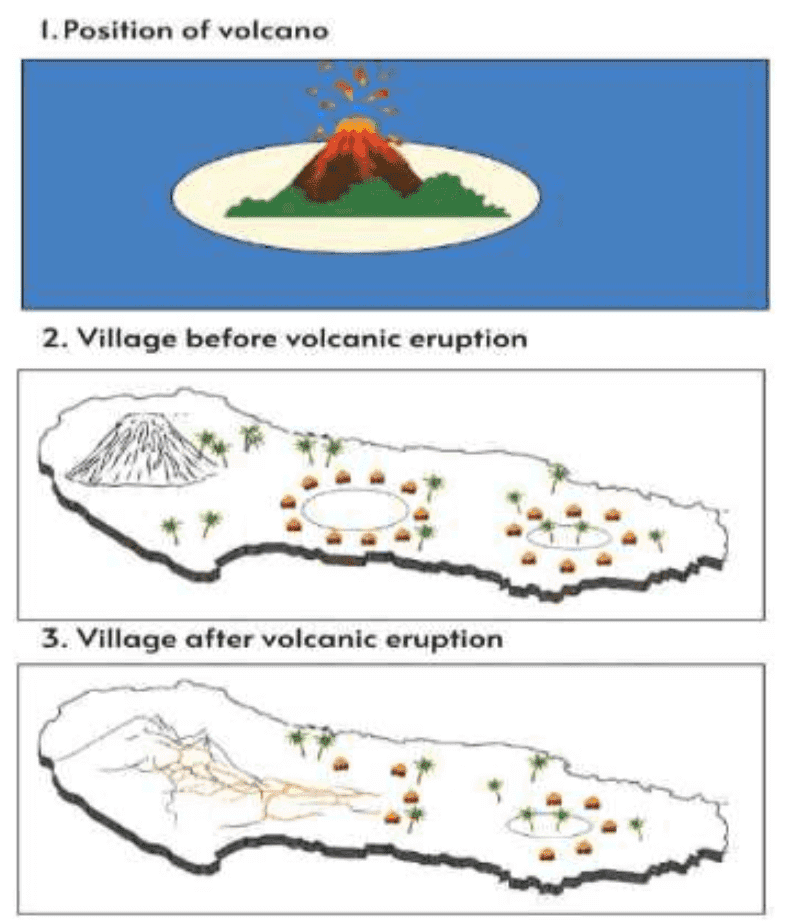
Volcano Position and Village Before and After Eruption
The three pictures show the position of a volcano, and a village before and after volcanic eruption. Summarise the information by selecting and reporting the main features, and make comparisons where relevant.
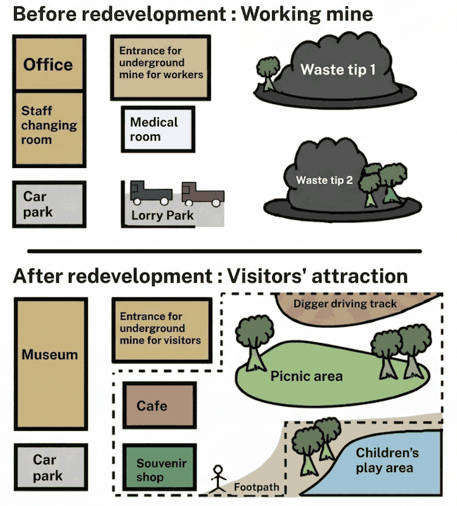
Coal Mining Site Before and After Redevelopment
The maps below show a coal mining site before and after redevelopment. Summarise the information by selecting and reporting the main features, and make comparisons where relevant.
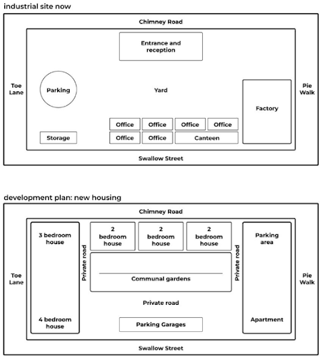
Plan to Redevelop an Industrial Site
The maps below give information about a plan to redevelop an industrial site. Summarise the information by selecting and reporting the main features, and make comparisons where relevant.
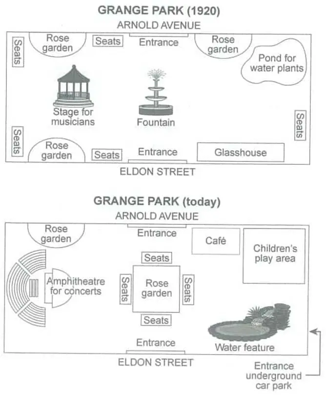
Grange Park Plans in 1920 and Today
The plans below show a public park when it first opened in 1920 and the same park today. Summarise the information by selecting and reporting the main features, and make comparisons where relevant.
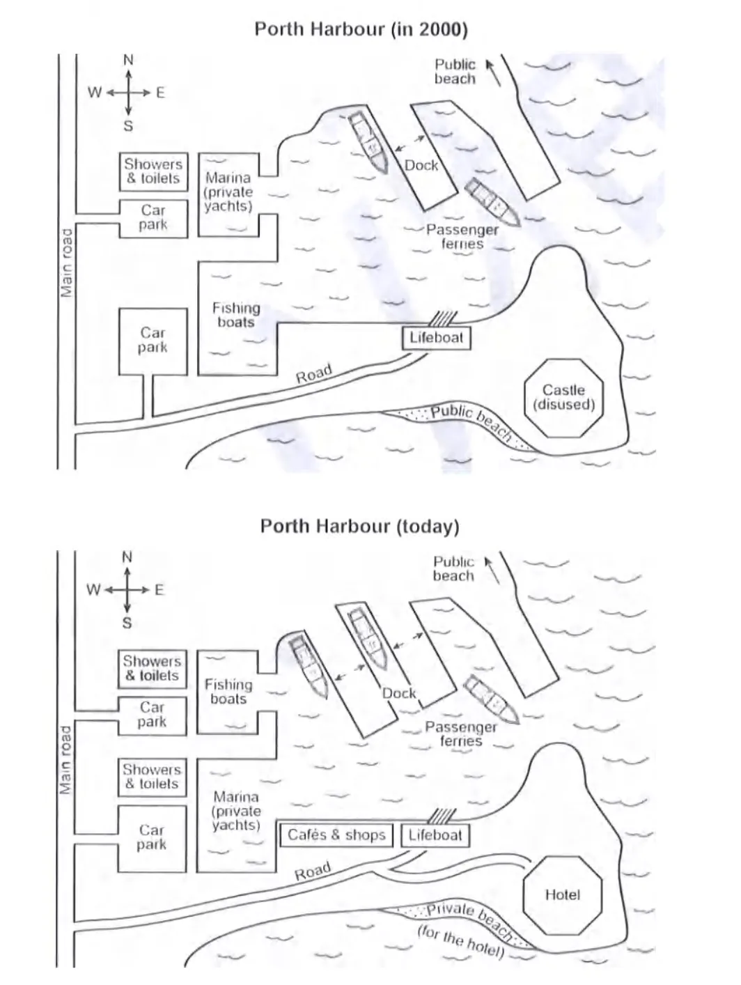
Porth Harbour in 2000 and Today Map
The plans below show a harbour in 2000 and how it looks today. Summarise the information by selecting and reporting the main features, and make comparisons where relevant.
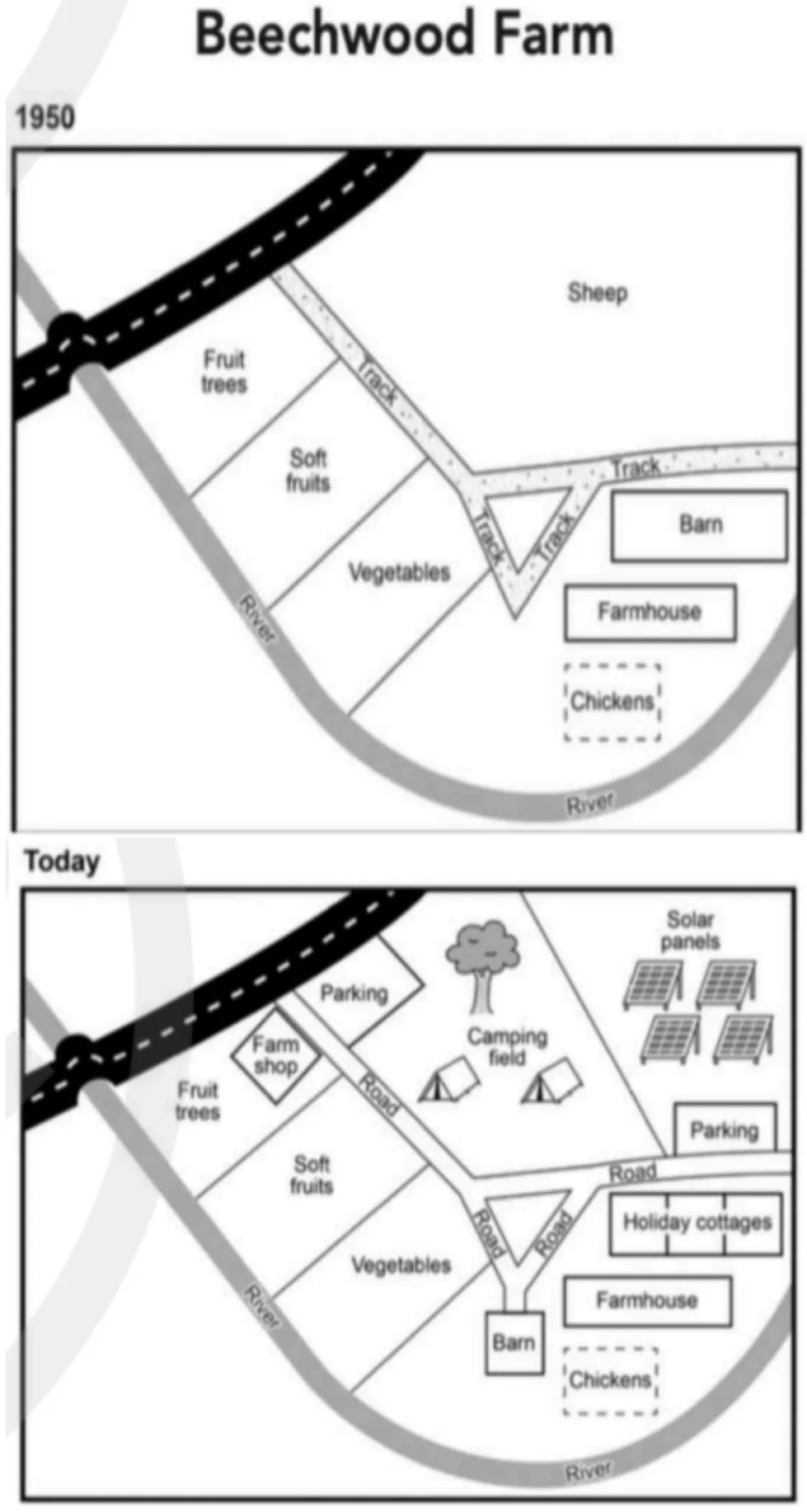
Beechwood Farm Site Changes from 1950 to Today
The plans below show the site of a farm in 1950 and the same site today. Summarise the information by selecting and reporting the main features, and make comparisons where relevant.
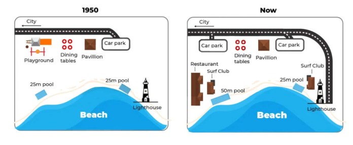
Australian Beachfront Area Maps 1950 and Today
The maps below show a beachfront area in Australia in 1950 and the same area today.
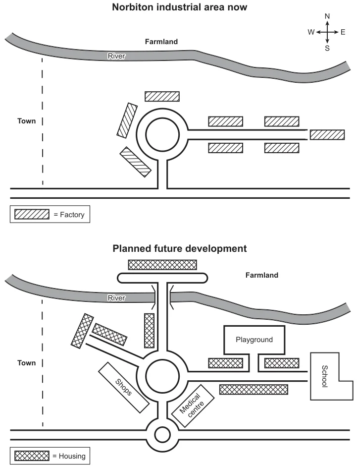
Norbiton Industrial Area Redevelopment Maps
The maps below show an industrial area in the town of Norbiton, and planned future development of the site. Summarise the information by selecting and reporting the main features, and make comparisons where relevant.
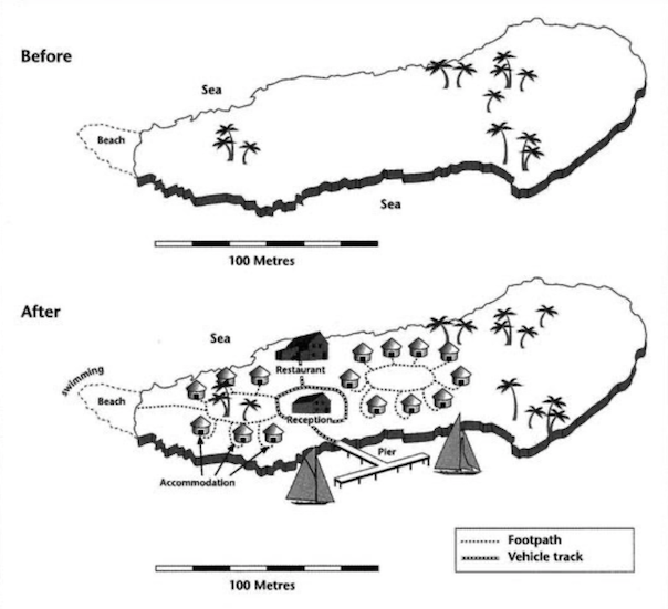
Island Tourist Facilities Before and After Development Map
The two maps below show an island, before and after the construction of some tourist facilities. Summarise the information by selecting and reporting the main features and make comparisons where relevant.