
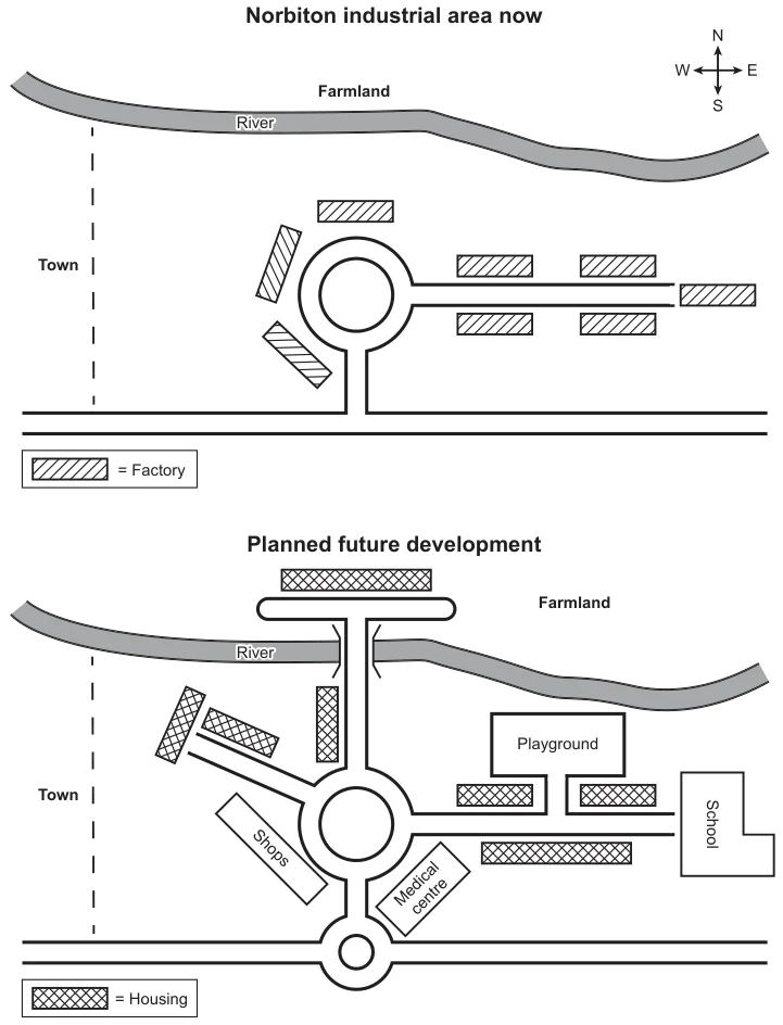
provide a detailed account of Norbiton’s current state and its projected developmental plans. A comprehensive analysis of the maps reveals a discernible shift towards increased residential infrastructure and a concomitant decline in industrial facilities. This transformation will chiefly take place in the western and northern regions of the town, with only a of farmland remaining untouched.
Currently, the town centre comprises a central roundabout, surrounded by factories, and a west-to-east thoroughfare. In the future, while the roundabout will persist, the factories will give way to commercial establishments, and new will emerge alongside a north-western avenue. Additionally, a new will be constructed in the south-eastern district. The existing eastward thoroughfare will be flanked by new residences and will feature a substantial playground to the north and a school at the easternmost boundary of the town.
Beyond the town centre, plans are underway to construct a small roundabout in the southern region that will . To the north, a bridge will span the river, and some of the farmland will be supplanted with housing, albeit not to the east, where no alterations are planned.